Trails
From Strolls to Summits: A Trail for Every Explorer
Check out some of the best trails in the Kootenays. Our recreational trails give you access to:

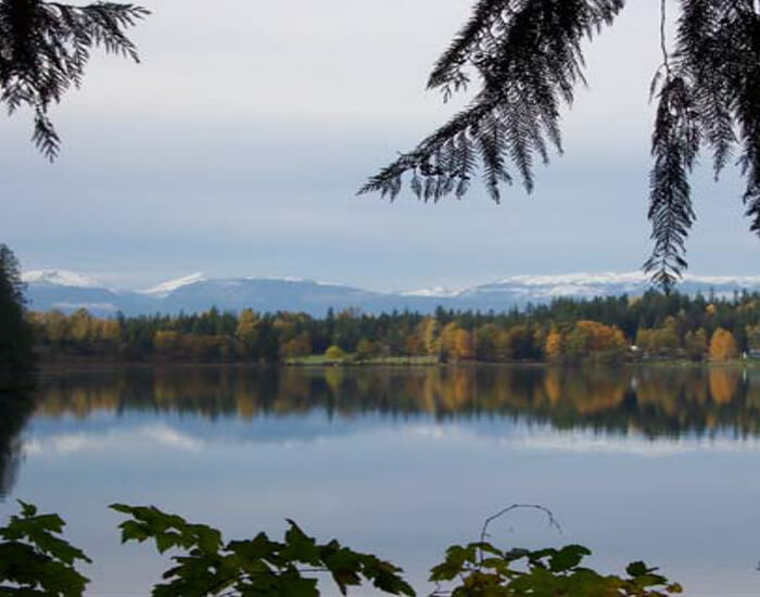
Gorgeous mountain lakes and rivers

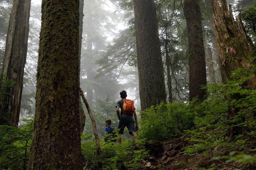
Old growth forests

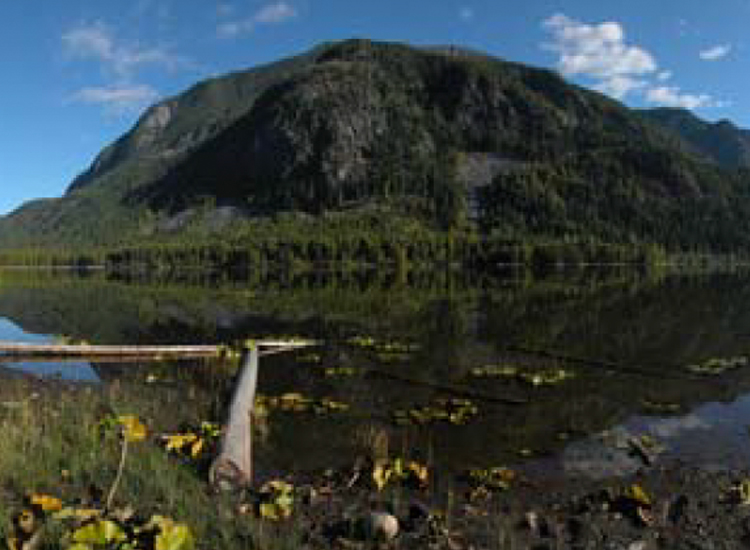
Epic views

Natural and developed hot springs

Spectacular bird watching

Fascinating ecosystems
Thanks to our community partners, you have dozens of trails to explore in the Nakusp area.
Discover our own 10 diverse trails, maintained by our passionate team of volunteers at NACTS.
Our trails cater to a variety of users, whether you’re a thrill-seeker on a mission or a contemplative nature enthusiast. Our multi-use trails are ideal for hikers, snowshoers, horseback riders and mountain bikers. Some trails are open to ATVers while others are reserved for low-impact hikers and walkers.
Hike, fish, paddle and relax on the beach - all in the same day.
Experience two of the best summiting hikes in BC, where you can hike up to 930 metres (more vertical and as steep as the famous Grouse Grind) with panoramic views. Or explore historic trails and interpretive nature walks with picturesque footbridges over raging rivers or quiet streams.
Your Guide to the NACTS Trails!
 Box Lake Loop
Rating: Easy
Distance: 1.3 km
Time: 1/2 hour
Surface: Compact dirt
Modes of Use: Biking, hiking
Take a gentle walk through a second growth cedar/hemlock forest, typical of most valleys in this area.
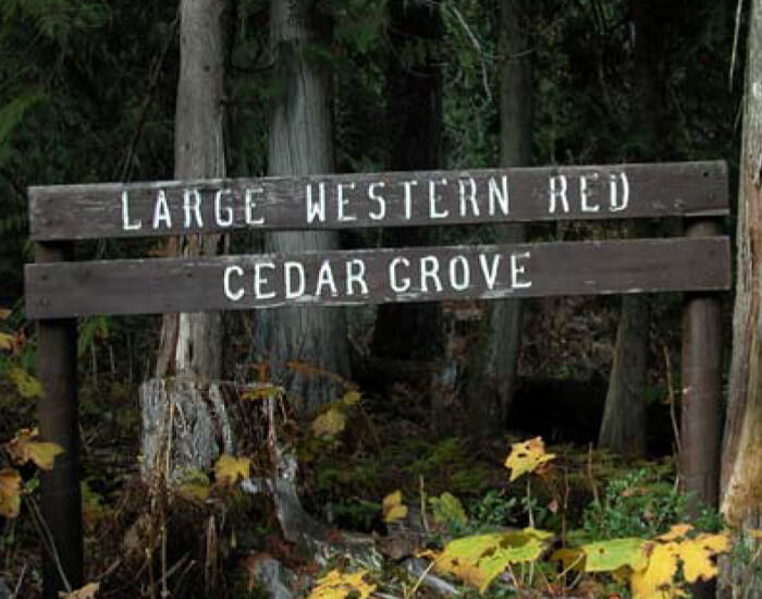
 Cedar Grove Trail
Rating: Easy
Distance: 1/2 km
Time: 1/2 hour
Surface: Compact dirt
Modes: Hiking
This gentle half-kilometre loop takes you through a stand of majestic old growth Western Red Cedar. Access superb interior rainforest habitat, untarnished by natural or industrial disturbances. The trees in the grove, some with a diameter of over two metres, are hundreds of years old.
 Hot Springs Trail
Rating: Easy-moderate hiking
Distance: 8.5 km,
One way Time: 3 hrs
Surface: Compact dirt, some rock
Modes of Use: Hiking, mountain biking, horseback riding, snowshoeing
Experience the magic of this all-season trail with great spring, summer and fall hiking, horseback riding and winter snowshoeing. This trail meanders along the side slope above the Kuskanax Creek from just outside Nakusp up the valley to the Nakusp Hot Springs, following the pioneers’ original packhorse route of 1912.


 Kimbol Lake Trail
Rating: Easy-moderate
Distance: 4 km one way
(Note: trailhead is located almost 1 km from the hot springs parking lot)
Time: 5 hour return trip
Surface: Compact dirt
Modes: Hiking
This is a great low elevation hike in spring, summer or fall. Follow the four-kilometre trail which winds through imposing cedar and hemlock forests along the southern slope of the Kuskanax Creek valley, and then climbs into the narrower Kimbol Lake valley.
 Kuskanax Mountain Trail
Rating: Moderate
Distance: 2.4 km to the summit
Time: Approx 3 hours return
Surface: Compact dirt
Modes: Hiking
Kuskanax Mountain looms to the northeast of Nakusp, a sentinel over the town. The trail up the mountainside is really an old fire road that is now used to access two spectacular viewpoints. The four-kilometre road, with its narrow, rutted, gravel surface, is passable by dirt bike, 4-wheeler or a high-clearance 4×4. If you prefer to walk, you can ascend the mountain in the quiet solitude afforded by the mainly second growth trees lining the roadway.

 Nakusp to Summit Lake Trail
Rating: Easy
Distance: 12 km one way
Time: Mode-dependant
Surface: Gravel railbed
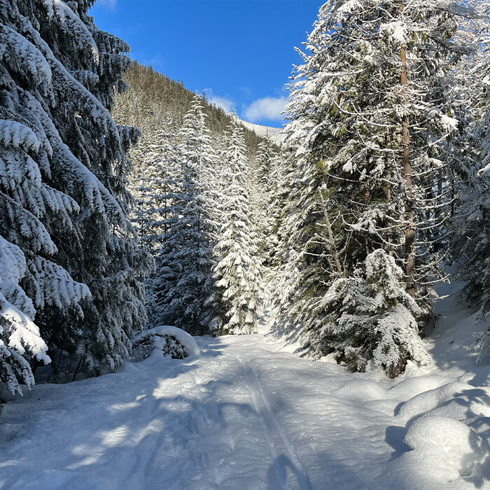
Modes: Hiking, biking, dirt biking, horseback riding, cross country skiing
Formerly the railway for the Nakusp Line, the Nakusp to Summit Lake Trail Trail climbs gently from Nakusp to Summit Lake and then descends to Rosebery, where it connects with the Galena Trail. The railway trail is ideal for cycling, cross-country skiing, jogging, or simply walking in surroundings both stunning and soothing.
 Saddle Mountain Lookout Trail
Rating: Moderate
Distance: 5.3 km one way
Time: 5 hrs return
Surface: dirt, rock
Modes: hiking
Enjoy this fantastic alpine hike. The trail ascends Saddle Mountain to a rocky knob above the treeline, a Forest Service fire lookout chosen because of its panoramic view of the surrounding peaks and valleys. The first part of the trail winds through moist, mature cedar/hemlock forests, typical of the area. Due to substantial rainfall and fertile soils, our region is often called BC’s interior rain forest.

 Peter Roulston Trail
Rating: Variable – rough drive, moderate hiking & snowshoeing
Distance: 1.5 km uphill
Time: 1 hr one way hike
Surface: Gravel road, forest path
Modes: 4X4, high clearance AWD, hiking, biking, snowshoeing
This old logging road on a south-facing slope winds through second-growth forest, offering a gentle ascent and descent. This user-maintained trail provides excellent cross country skiing and snowshoeing. There are two large bridges over creeks, and smaller temporary bridges over large water bars.
 Vickie’s View Trail
Rating: Easy
Distance: 4 km
Time: 2 hours one way hiking
Surface: Compact dirt
Modes: Hiking, biking, cross country skiing, snowshoeing
After going up the road and along a short forest path, Vickey’s View is a viewpoint overlooking the upper Arrow Lake, Monashee mountains and the town of Nakusp. This is a favorite quick invigorating hike to a spot where locals like to look down and identify their house below or snowshoe up to celebrate Christmas Day. A picnic table and rustic bench make it a perfect spot for lunch.


 Wrap Around Nakusp Trail
Rating: Easy
Distance: 5 km
Time: 1 hour
Surface: Pavement, gravel, dirt
Modes: Walk, bike, roll, push
Dedicated to the Outdoors. Committed to Our Community.
We are committed to collaborating with our community partners, tourism organizations and other recreation groups in the region so we can provide you with a central hub of information.
Together, we explore. Check out our partners’ trails!
We are committed to collaborating with our community partners, tourism organizations and other recreation groups in the region so we can provide you with a central hub of information.
Find Out What Makes our Trails Unique

Uncrowded and unspoiled
Hiking in the Nakusp area means you can still access uncrowded and unspoiled outdoor adventure opportunities. On some trails, at certain times, it’s rare to see another party and even on the busier trails, you may only see a handful of other users.

Accessibility
Most of our trails are less than a two-hour drive from Nakusp. Unlike other regions, you don’t have to drive for most of the day, or get up at 3am, to have a fulfilling experience in nature.

Multi-use trails for all types of users
We are committed to maintaining and building inclusive multi-user trails. Our select multi-mode trails support a diverse array of activities from hiking and snowshoeing to mountain biking, horseback riding and ATVing.
Stay Safe Out There!
Familiarize yourself with Leave No Trace principles
Check the weather forecast and trail conditions, and plan accordingly
Stay on designated trails and share with others
Make noise (sing, talk, clap) to alert wildlife
Cyclists and ATVs yield to everyone and hikers yield to horses
Be prepared for hiking - have solid walking shoes/boots, water and nutritious food, first aid supplies, comfortable clothing (including layers) that’s appropriate for the weather
Prepare for the unexpected
Tell someone where you’re going and when you expect to return
Be prepared to be in areas without cell service
Travel in pairs or groups and keep kids in sight at all times
Keep pets under control, keep them at home if not allowed on certain trails, and be aware they may pose a hazard with backcountry wildlife
Use this information at your own risk. Trail users assume all responsibility for personal injury or damage to equipment. Click here to view our disclaimer.
For more information, visit: